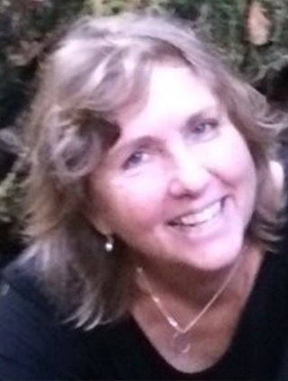
Employer: West Coast Watershed, North Coast Resource Partnership
Title: Director, Strategic Planning & Communications at North Coast Resource Partnership; CEO and Co-Founder at West Coast Watershed
Location: Sonoma State University, California
Pathfinder Topic: Wildfires and Vegetation
- Karen Gaffney has over thirty years in community-based conservation, watershed planning, private and public sector community development.
- West Coast Watershed advances innovative conservation and stewardship initiatives, with an emphasis on landscape ecology, land use, watershed mapping and GIS analysis. Clients and collaborators include local, state and federal agencies, foundations, tribes, private businesses, nonprofits and resource conservation districts. The projects integrate multiple objectives - including community health, economic vitality and environmental enhancement - and we strive to gain the best return on investment in everything we do.
- Things have just gotten so intense in the North Coast region that she decided about 2 years ago to focus full time on the North Coast Partnership. So, the partnership, tribes, and counties, as well as thousands of stakeholders in the North Coast region, ranging from agencies to municipalities to private sector firms to NGOs and the partnership has been working together for about 18 years to basically enhance the quality of life for communities and landscape escapes in the North Coast region, which is about 12% of California's footprint. To date, the partnership has brought in over $100 million in funding in this economically disadvantaged region. It's an ecosystem function, built infrastructure, climate adaptation, carbon sequestration, forest health, but also community health and safety and economic vitality.
- Karen is using the Lidar data and working with various other state and philanthropic organizations to implement this plan to include biomass, feedstock utilization, fuel load reduction, capacity enhancements in the tribal and nonprofit and other communities in the North Coast region so that we can kind of get more impact.
- Karen and her Partners, Mark Turkman and Kass Green, are interested in air quality and how that relates to community health and safety as it relates to emissions from wildfires and burning forests.
- They are potentially looking to utilize WIFIRE at some point to expand more on carbon, fires, and air quality as well as the work with CAL FIRE and providing jobs to the North Coast community, ecosystem restoration, and tribal involvement.
- Mark Turkman works with NCRP in California performing mapping, vegetation, fuels and other natural resources trying to create data products and sets that are actionable for people on the ground. His team also works with counties that have end users who are managing land. They are also working to bridge the gap between technology and maps that are fine scale enough to inform data management decisions on the ground. They also do a lot of remote sensing work with Lidar, high resolution orthoimagery, moderate resolution satellite imagery, etc.
- CAL Fire has been involved in helping North Coast develop a regional resilience plan: (https://northcoastresourcepartnership.org/resilience-plan/), which has a strong focus on wildfire resilience.
- Another area Karen and her team have been interested in is the story about how the riparian corridor is acting as a buffer in fires, the air quality role of vineyards and wildfire resiliency along with the range lands and vineyard cultivated lands which also play a role.
- Mark experiences challenges in trying to bridge the gap between technology and maps that are fine scale enough to inform data management decisions on the ground. Karen and Mark are invested in bringing the WIFIRE resource to the region to its full extent in order to use the new and improved viewer, sensor, or sensor combination to enhance the resolution and accuracy of the data.
Relevant Satellite Products, Data, and Tools
Coastal and high-tide mapping systems, LIDAR, sea-level rise data and extreme weather data.
