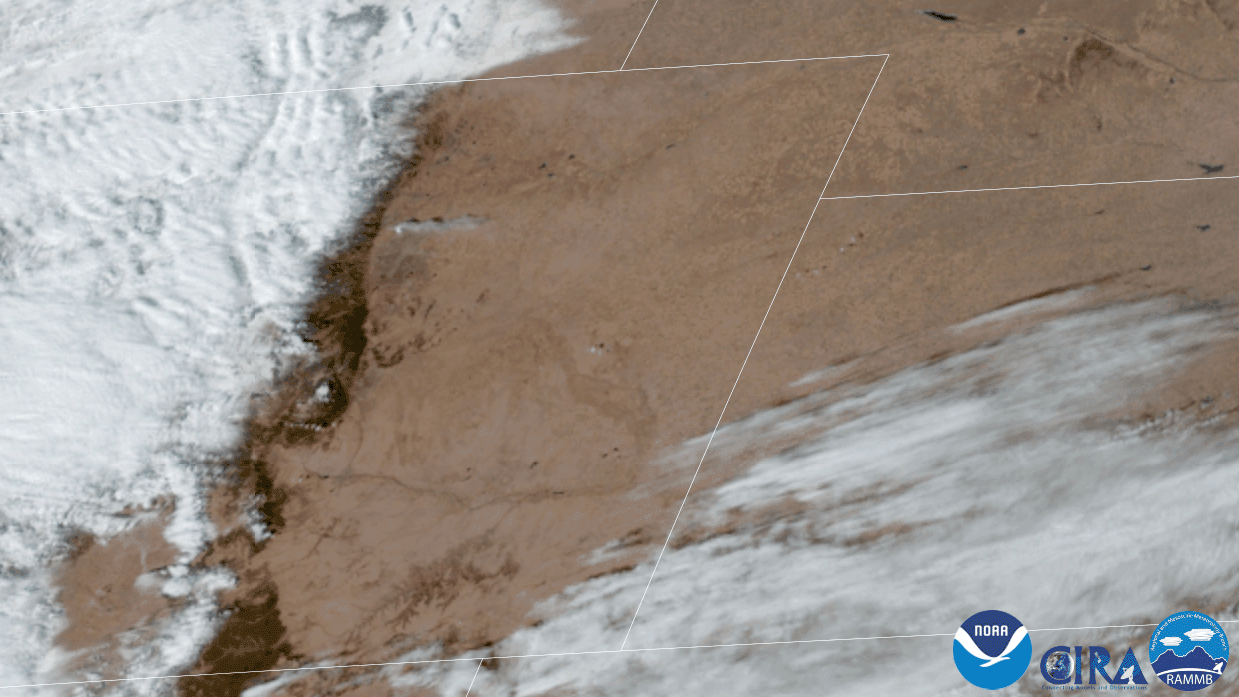
On the afternoon of Thursday, Dec. 30, the GOES East satellite captured GeoColor imagery of the rising smoke plume from the quick-moving Marshall fire in Boulder County, Colorado.
Wind gusts from 70 to 100 mph occurred near the base of the Front Range Foothills, including Boulder and along Highway 93 south toward Golden. The strong winds fanned a grass fire that originated near the town of Marshall, which quickly spread east to Superior and Louisville respectively. Approximately 1,000 homes and structures, including several businesses, were destroyed and three people are still missing. The Marshall Fire has been named the most destructive fire in Colorado history

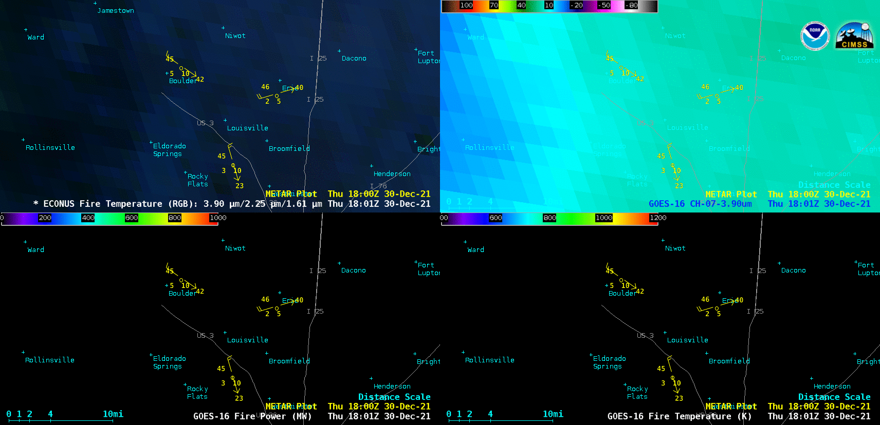
This four-panel imagery above from GOES-East shows the fire temperature as well as the fire power and temperature derived products. The peak fire power detected was 1848.94 megawatts and peak fire temperature was 1632.94K (nearly 2,500 degrees F). More imagery from the fire can also be found at the Cooperative Institute for Meteorological Satellite Studies’ satellite blog.
The GOES East geostationary satellite, also known as GOES-16, keeps watch over most of North America, including the continental United States and Mexico, as well as Central and South America, the Caribbean, and the Atlantic Ocean to the west coast of Africa. The satellite's high-resolution imagery provides optimal viewing of severe weather events, including thunderstorms, tropical storms, and hurricanes