
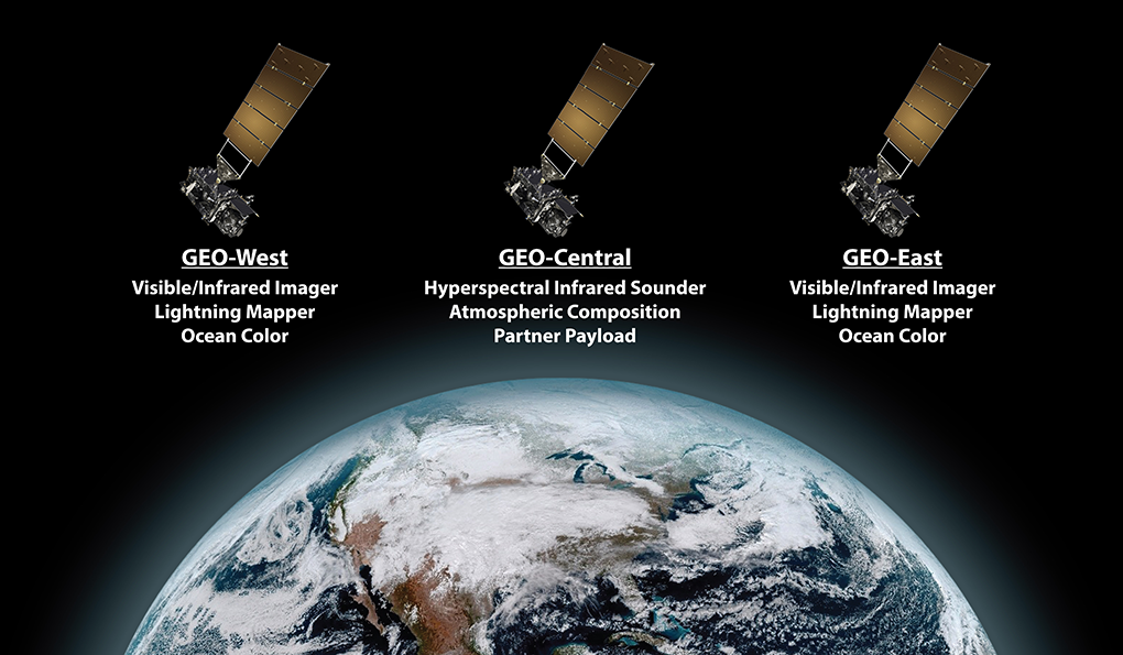
NOAA evaluated a range of space architecture options for delivering the recommended GeoXO observations effectively and efficiently. NOAA is planning a three-satellite GeoXO operational constellation. Spacecraft in GEO-East and GEO-West positions will carry an imager, lightning mapper, and ocean color instrument, and a centrally-located spacecraft will carry a sounder and atmospheric composition instrument. This constellation can also accommodate a partner payload on the spacecraft flying in the central location.
GeoXO Spacecraft Status
On July 26, 2022, NASA awarded GeoXO Spacecraft Phase A Study contracts to Lockheed Martin Space of Littleton, Colorado, and Maxar Space LLC of Palo Alto, California. Each company conducted a 10-month definition-phase study of a geostationary GeoXO spacecraft.
The results of these studies were used to set performance requirements for the GeoXO spacecraft development contract. NASA posted the request for proposals for GeoXO spacecraft development on Sept. 29, 2023. NASA plans to select a development contractor for the GeoXO spacecraft in late May 2024.
GeoXO Instruments
NOAA has recommended a suite of instruments to meet the observational needs of NOAA’s environmental monitoring mission and the satellite data user community. NASA has awarded contracts for Phase A studies of each instrument as part of GeoXO formulation activities. These definition-phase study and development contracts will help design the instrument concepts, mature necessary technologies, and help define potential performance, risks, costs, and development schedule. The results of the studies will be used to set performance requirements for instrument implementation contracts.
The GeoXO instrument array is subject to final program approval.
Industry Collaboration
NOAA and NASA will work with industry partners to develop the instruments and spacecraft that will deliver the recommended observations.
The information on this page is subject to change as the GeoXO program develops.