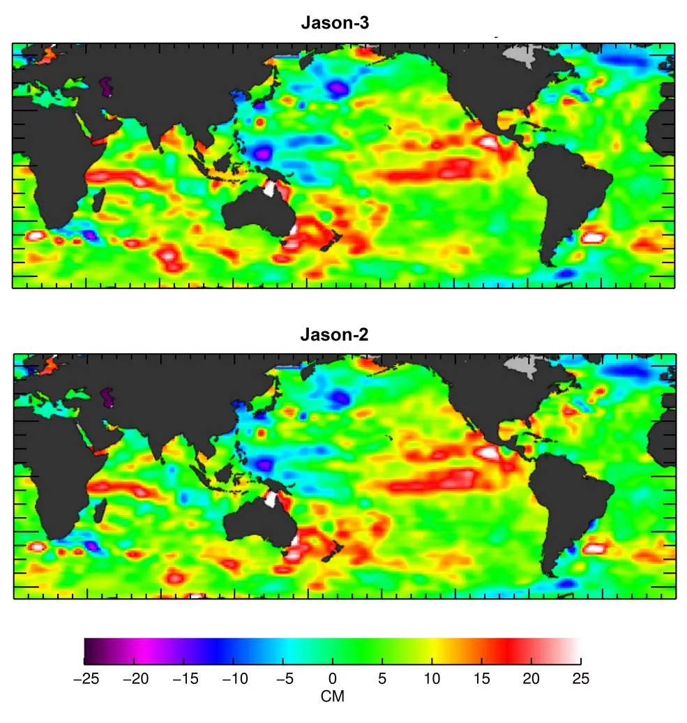
Launched on January 17, 2016, the Jason-3 satellite has produced its first map of sea surface height, which corresponds well to data from its predecessor, Jason-2. The map was generated from the first 10 days of data collected once Jason-3 reached its operational orbit of 830 miles (1,336 kilometers) last month. It shows the state of the ongoing El Niño event that began early last year.
Data from Jason-3 will be used to monitor climate change and track phenomena like El Niño. It will also enable more accurate weather, ocean and climate forecasts, including helping global weather and environmental agencies more accurately forecast the strength of tropical cyclones. Jason-3 data will also be used for other scientific, commercial and operational applications worldwide.
Read the full story at http://go.usa.gov/cGJ8B