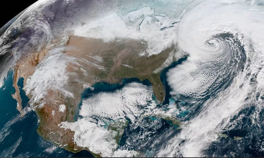
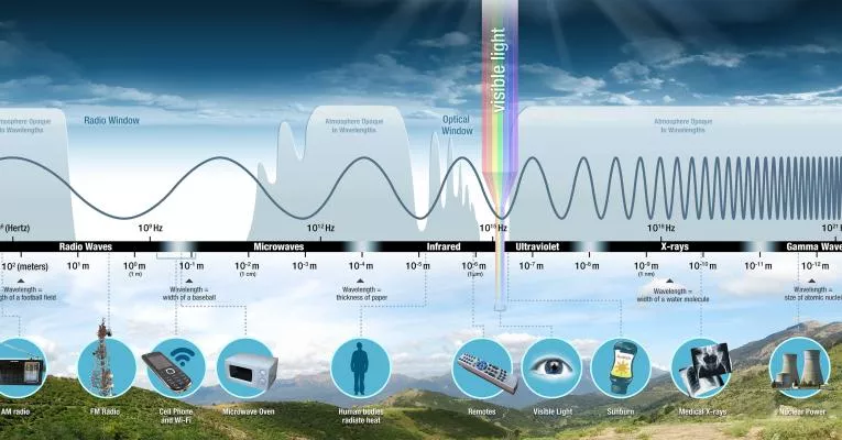
GeoXO will provide real-time, high-resolution visible and infrared imagery for monitoring Earth’s weather, ocean, and environment. The GeoXO Imager (GXI) will be a multi-channel passive imaging radiometer designed to observe the Western Hemisphere and provide variable area imagery and radiometric information about Earth’s surface, atmosphere, and cloud cover.
GXI will measure energy at different wavelengths along the electromagnetic spectrum. GXI is planned to include 18 channels, or bands, that will view Earth in visible and infrared wavelengths. Each channel will provide information about various features of Earth’s surface or atmosphere, such as vegetation, water, clouds, moisture, and smoke
GXI will be used for a wide range of applications related to severe weather, hurricanes, aviation, natural hazards, the atmosphere, ocean, and cryosphere. GXI will monitor cloud formation, atmospheric motion, convection, land surface temperature, fire, smoke, dust, volcanic ash plumes, aerosols, air quality, and vegetative health, and more.
Improvements Over Current Capabilities

GXI will improve upon the GOES-R Series Advanced Baseline Imager (ABI) by adding two new channels and improving the resolution of seven channels on the current imager. These upgrades will provide more precise observations and improve water vapor measurements.
NOAA plans to add .91 µm (near-infrared) and 5.15 µm (infrared) channels to GXI to measure water vapor in the atmosphere. A .91 µm channel will provide information about daytime water vapor in the lower troposphere, an important component of severe weather. A 5.15 µm channel will measure water vapor in the lower troposphere, improving the measurement of water vapor near the ground.
The GXI channels with improved resolution include two visible channels, three near-infrared channels, and two infrared channels. Higher-resolution imagery will allow forecasters to identify severe weather and fires sooner, providing additional time for community preparedness and faster response times. A key advancement planned for GXI is to improve the resolution of the 3.9 μm band from 2 km to 1 km. This will allow for the detection of fires four times smaller than current capabilities, potentially allowing for earlier identification of fire ignition. Earlier identification may allow first responders to contain the fire before it gets out of control. NOAA also plans to improve the resolution of the 0.64 µm visible band to 250 m (from 500 m) to allow better identification and characterization of small clouds and help forecast convective initiation.
Benefits of a Geostationary Imager
High-resolution imagery is the backbone of Earth observations. Geostationary satellite imagery provides a constant view of the same area, helping forecasters and emergency officials identify and track severe weather conditions and environmental hazards as they happen to aid real-time decision-making and short-term forecasts and warnings. GXI will provide critical data for the protection of life and property and the enhancement of the national economy.
Severe Weather
Imagery is critical for severe storm detection and analysis. GXI will be used for monitoring and tracking cloud formation, analyzing cloud properties, tracking atmospheric motion, and monitoring moisture in the atmosphere. This data will help forecasters identify where new storms are likely to form, which storms are likely to become severe, and when a storm is weakening. GXI will also help forecasters detect heavy rainfall and assess the risk of flash flooding. Geostationary satellite imagers are also extremely useful for providing real-time data during radar outages or in areas where radar coverage is sparse. In addition, wind speeds derived from tracking clouds using visible and infrared imagery are fed into numerical weather prediction models, improving their forecasts.
Wildfire Detection and Monitoring
The visible and infrared bands on the GXI will be critical tools for detecting and monitoring wildfires. The shortwave infrared bands will be used to detect and track hot spots, while visible imagery will track smoke plumes. GXI will provide information about the size and intensity of fires, track fire progression and spread in real-time, and detect changes in a fire’s behavior to predict its motion. The frequently updating imagery is critical for rapidly advancing fire fronts, such as in the case of wind-driven fires. Firefighters will use imagery to help deploy firefighters both on the ground and to assess the safety of aircraft operations.
Hurricane Forecasting and Tracking
GXI will be a key tool to help forecasters identify hurricanes and analyze the environment the storm is moving into. This is especially important while they’re over the open ocean. far away from land-based radars. Without an imager, forecasters would be blind to dangerous hurricanes over the ocean heading toward populated coastal areas.
Forecasters use near-real-time visible and infrared imagery to pinpoint the location of hurricanes, estimate their intensity, and determine their speed and direction of movement, all essential inputs for model forecasts. GXI will also aid predictions for rainfall intensity and potential flash flooding associated with hurricanes.
Climate Monitoring
Cloud trends from satellite imagery are important for climate monitoring and data from GXI will be used for long-term climate variability studies. GXI will extend and improve the geostationary imager climate data records that go back decades. GXI will also contribute to the growing climate data records from an international “GEO Ring” of satellites that allow for the study of key climate processes at fine spatial and temporal scales and in conjunction with other satellite observations.
Environmental Hazard Detection and Tracking
GXI will provide critical data for detecting environmental hazards like smoke, dust, aerosols, fog, volcanic ash, sulfur dioxide, turbulence, aircraft icing, and sea and lake ice, benefitting public health and safety as well as the economy.
GXI Status
On March 13, 2023, NASA selected L3Harris Technologies Inc. of Fort Wayne, Indiana, to develop the GeoXO Imager. The contract includes the development of two flight instruments as well as options for additional units. The contract scope includes the tasks and deliverables necessary to design, analyze, develop, fabricate, integrate, test, verify, evaluate, support launch, supply and maintain the instrument ground support equipment, and support mission operations at the NOAA Satellite Operations Facility.
Related Links
- Advanced Baseline Imager (ABI) webpage
- ABI Fact Sheet
- ABI Bands Quick Information Guides
- NOAA Star GOES Image Viewer
The information on this page is subject to change as the GeoXO program develops.
