Twenty-five days after JPSS-1 (NOAA-20) was launched into Earth orbit, NOAA-20 sent back its first Visible Infrared Imaging Radiometer Suite (VIIRS) science data on December 13, 2017, as part of a series of instrument activation and checkouts that is taking place before the satellite goes into fully operational mode. VIIRS is one of the key five instruments onboard NOAA-20 that will improve day-to-day weather forecast and environmental monitoring, while extending the record of many long-term observations of Earth's climate.
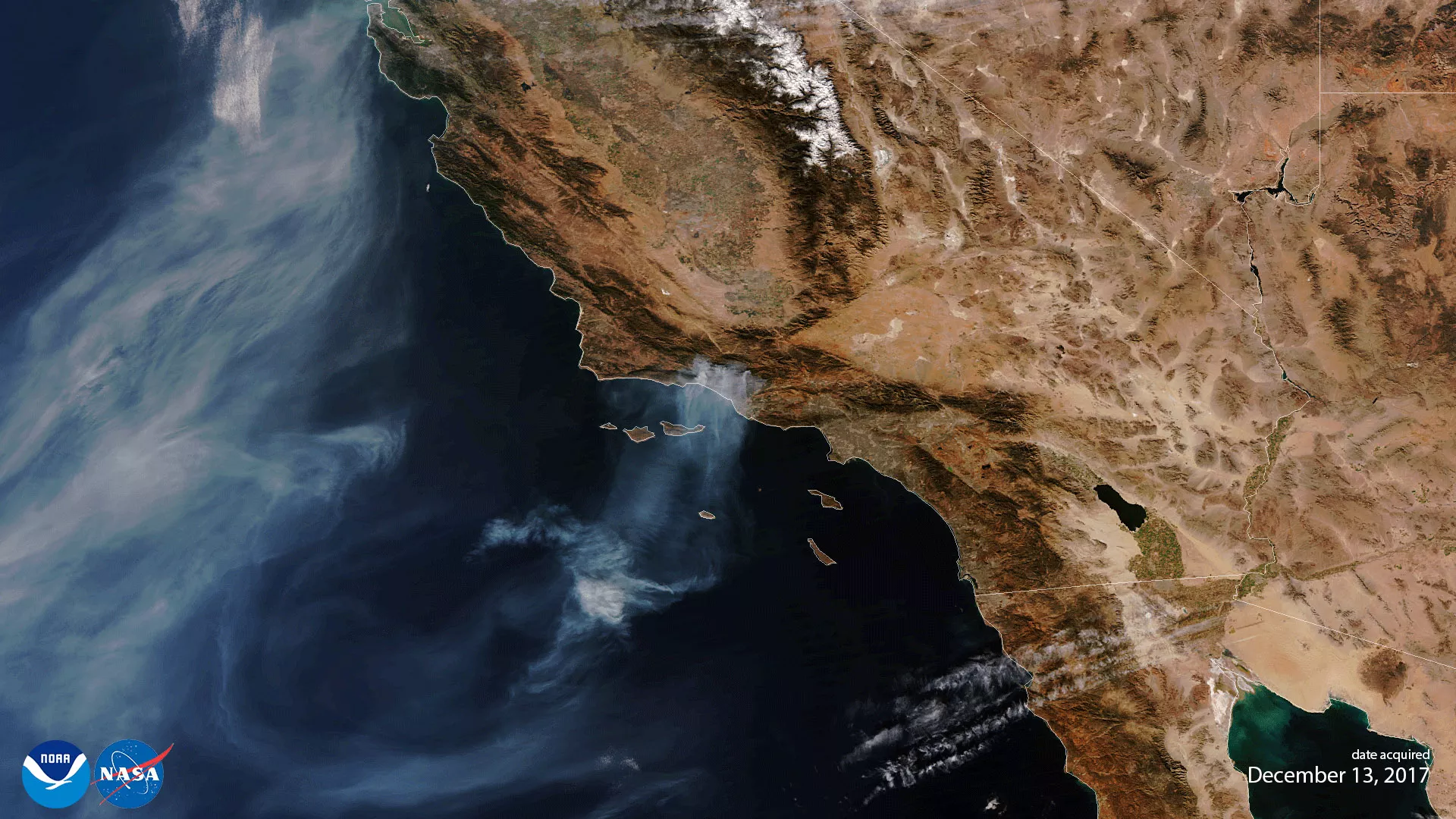
This VIIRS true color image captured the aggressive wildfires across the Southern California region which forced thousands to flee their homes. As of Wednesday morning, December 13, 2017, the Thomas Fire was the fourth-largest fire in California history, and it continues to generate smoke and plumes as it enters its second week. The fire spanned more than 370 square miles and remains the strongest blaze for firefighters to battle in Ventura and Santa Barbara counties. NOAA-20 VIIRS will help monitor active fires globally for many years to come.
DISCLAIMER: Until NOAA-20 (JPSS-1) satellite has been declared operational, its data are preliminary and will be undergoing testing. Users receiving these data through any dissemination means (including, but not limited to, PDA and HRD) assume all risk related to their use of the NOAA-20 data and NOAA disclaims any and all warranties, whether express or implied, including (without limitation) any implied warranties of merchantability or fitness for a particular purpose.